About us
Using cutting edge laser scanning technology combined with decades of architectural experience, 3D Building Scans provides 2D imaging and 3D models of buildings, infrastructure and even whole urban environments.
3D laser scanning has revolutionised the surveying industry by enabling the provision of advanced imaging on site. Surveys can therefore be produced quicker and cheaper than ever before. 3D Building Scans uses this advanced surveying technology to provide clients, ranging from architectural and construction to engineering and environmental, with high-quality digital mapping, inspection and surveying services.
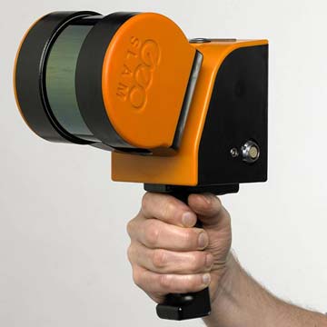
Using Zeb-Horizon technology in conjunction with a Matrice 600 Pro commercial Drone, 3D Building Scans can survey buildings and hard-to-reach infrastructure quicker than traditional surveying methods with a high degree of accuracy.

With a data collection rate of 300,000 points per second over 100m, and an accuracy of 1-3cm, the Zeb-Horizon is suitable for a vast array of applications, including:
- Measured building surveys
- Urban environment surveys
- Infrastructure surveys
- Photographic surveys
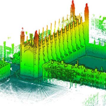
Once the surveys have been undertaken on site, we can then produce 2D plans, sections and elevations, or 3D models of the surveyed buildings and or infrastructure. 3D laser scanning is the ultimate method for surveyors to capture buildings with exceptional accuracy and detail.
3d laser scanning
A laser scanner is a measuring device that records geometrical information about any object or surface within its field of view. The collected data is a dimensionally correct 3D representation of the scanner’s immediate environment.
Laser scanners work by rapidly rotating a laser beam and recording up to a million angular and distance measurements every second. The advance of laser scanning has changed the way the surveying industry works.
The data captured by a laser scanner is known as a point cloud and, depending on the site, can contain billions of 3D points. The point cloud is a very rich data set and can be used to create drawings and construct 3D models for a wide variety of purposes.
Critically, 3D scanning provides the surveyor with a powerful toolkit to accomplish previously unattainable measurement goals.
Why use a 3D laser scanner
- Rapid, accurate data capture
- Complete data collection ensures that no site revisits are needed
- Highly detailed measurements
- Cost effective
- Enables 3D modelling
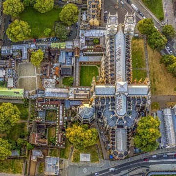
Measured building surveys
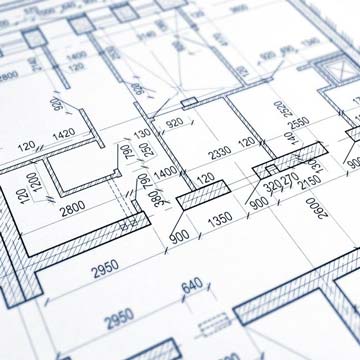
Using the latest technology, 3D Building Scans offers measured survey services which bring real-world buildings into the virtual environment. Our measured building surveys provide detailed accurate models at 1:1 which can be set up and printed to the appropriate scale, showing all the structural elements and architectural features, quickly and efficiently.
Deliverables can be produced in a variety of formats. Point cloud data from laser scanners can be supplied almost immediately, allowing instant access to raw data dimensionally. Outputs also include CAD, 2D plans, maps and drawings, cross sections, Elevations and 360-degree panoramic photographs.
Plans can be as detailed as required. A survey would typically display all structural features including walls, windows, doors, beams, floor and ceiling heights. But additional items and information can always be added, including fixtures and fittings, electric points, light switches and fittings, radiators and furniture.
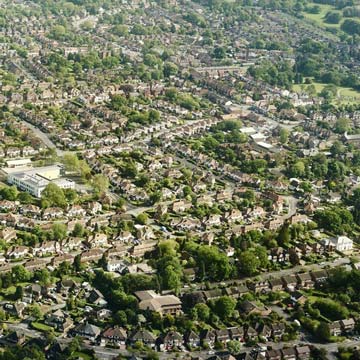
Topographical surveys
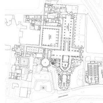
A topographical survey is an accurate representation of a specified area of land, illustrating all natural and manmade features with levels. Shown as three-dimensional points, all features including the property, natural land features, and physical boundary details are presented on a scaled survey drawing.
The advantages of laser scanning are particularly evident when surveying vast, open topographical areas. 3D point clouds can be created in minutes, clearly detailing entire landscapes with ease and accuracy. 3D Building Scans offer topographical surveys of any site, from a single plot to a large multi-acre development.
Residential and commercial lease plans
Every new lease lasting seven years or more must have a compliant lease plan which has to be registered with the Land Registry. A lease plan is an appropriately scaled metric drawing depicting the land or part of a building over which the holder of the lease has exclusive or shared access.
For a Lease Plan to be compliant with the requirements of the Land Registry it must include the following:
- Detailed floor plans at a scale of either 1:100 or 1:200
- A location plan at a scale of 1:1250
- An indication of orientation, such as north point
- A representation of the property and its boundaries
- Sufficient detail to be identifiable
Using laser scanning technology, 3D Building Scans offers a cost-effective method of producing a detailed lease plan survey, having determined boundary and important feature positions, that complies with all Land Registry requirements.